Thursday, March 27, 2014

The final install: Atauro Island

My last day for field work in Timor Leste gave rise to the installation of the 8th and final station.  Compass Charter arranged for us to leave Dili at 7:30 in the morning, and return from Atauro Island at 3:00 in the afternoon.  We were all worn down from the prior week of furious paced driving and field work, but there was a sense of jubilation as we began the day.  Most of the crew had never been across the Wetar Strait to visit Atauro Island, providing an extra element of excitement.  We loaded up the gear on the boat and headed north towards the village of Beloi.

About 3/4 of the way to Atauro, we were floating above 3 km of water at this point.

The ride was absolutely fun.  The water was calm, and the low angle lighting of the morning gave an etherial feeling to the start of the day.  As we approached the island, the volcanic nature of the Atauro was apparent, as well as the fact that the island is actively uplifting - there are wave-cut terraces along the south coast that form a stair step pattern that appear to be marching uphill in succession.  The boat nested adjacent to the beach in Beloi Village, right along the stretch of beach where Barry's Place is located.  We unloaded the gear and set out to continue forward with our on-the-fly logistical planning.

The boat crew, an Aussie tourist, the seismo crew, and the gear - all sprawled out on the inviting shore of Beloi.
As much as we wanted to simply jam the seismometer into the sand and spend the rest of the day lounging on the beach, we managed to track down Beloi's town administrator and some motorbike/boxcart transportation.

Rolling in style down the road.  Armando and Marcel are protecting the gear...and doing so with great style and finesse.  This was the most enjoyable ride of the entire field season - a perfect contrast to the rigors of driving across Timor's brutal roads!
We made it to the Administrator building and were convinced the site would be secure enough to leave the equipment.  It is also about as far from the coast as we could manage, a good thing for the quality of the record.  The installation took at least three hours due to the intensely hot overhead midday sun roasting us all like fried bananas and the fact that I did not bring a cable that allows for use of a laptop and therefore, a faster program configuration.  Nonetheless, we persevered - with the aid of Marcel climbing a nearby coconut tree and delivering some nectar of the gods - and established the final seismic station.

The 8th station in Timor Leste.  Beloi district Admin., Eugenio, Ol' sweaty L, Marcel, Bela, and Armando posing in front of station.  The watchgoat off to the right just walked out of view.
We had about an hour an a half to relax on the beach and have some lunch before catching the boat back to Dili.  We had lunch at Barry's, then we strolled out to the beach to swim, rest in the shade, and pick up some local fish.  Armando had the best looking haul of freshly caught beasties:

A few beauties destined for Armando's barbecue back in Dili.
The ride back was just as pleasant as the morning's, but had the added sense of accomplishment.  I probably had a bit of a high from heat stroke as well.  Talk about cheap thrills.  Even better, we saw a few different species of marine wildlife along the way.  Flying drift fish jumped out of the boat's wake and cruised above the water surface for 10's of meters.  Tony, the charter captain, spotted a group of dolphins and doubled back so we could watch:


A truly excellent moment.  Looking back on Atauro, the light was diffuse and the water was smooth. A perfect end to a productive field campaign.

Leaving the new and improved Atauro Island, seismometer and all.

Tuesday, March 25, 2014

The balance between good and evil

It was a mixed experience completing the install in the town of Same.  The travel was brutal, but the destination was excellent.  Heading south from Dili, the road to Same traverses a set of high topographic ridges and emerges in the lush southern side of Timor Leste.  We set out midday on Sunday to be ready to work on Monday morning.  The road condition is beyond disrepair, yet busses, trucks, 4WD cars, and motorcycles use the thoroughfare like any other road.  The 100+ km stretch winds high up into the misty tops of the interior mountains, and there is rarely piece of road that allows for a vehicle to go above 3rd gear.  The total trip was over five hours, and played out more like a full-body workout than a road trip.  We had a full crew packed into the IPG Land Cruiser, with little room to spare.  If I didn't fully brace myself for each massive pothole or section of completely broken road, I would be thrown around the car like a rag doll.  My arms and shoulders are tired from clutching to the edge of the seat and window of the car.  Worst of all, the precious seismometer was being subject to all of this violence, and I worried that it would be damaged.  We arrived in Same around 6 pm after passing through a short-lived downpour.
  
The setting of the town is spectacular.  Steep topography rises along the northern margin - the same topography we descended to arrive in town.  The clouds sweep up the rise and gather along the high points of the surrounding mountains.  The slopes are covered in lush vegetation - trees suited to specific elevation ranges along with dense undergrowth.  Delicate pine-like trees provide shade for wild coffee plants.  Sunset time came along, and did not disappoint.  The interplay of the mountain horizon, massive thunderclouds, and rich hues of colored sky provided excellent reward for a hard-travelled day.
 
In the morning, we visited the local District Administrator and once again were given the go ahead to install on their grounds.  The road into town that passed in from of the Admin complex was recently repaved, providing a strong contrast to the aforementioned treachery.  The station went in smoothly, and it appears that the sensor survived the ride to its temporary home. 

The station in Same.  This photo just missed the formation of lenticular clouds in the mountains above.
The return trip home was a bit more comfortable because we had gained some space in the car.  We encountered a group trying to clear the road of a massive downed branch.  Marcel, Armando, and Eugenio jumped out to help cut the branch in half - with a machete.  Good ol' Timorese ingenuity.  The road was quickly cleared and we passed through, but not before I was able to snap a few photos, including some shots of coffee plants.  Along the way, the crew reaped the usual bounty of local produce.  
The crew picking up goods at produce stands.  Coffee plants are growing behind the stands, with large shade trees above.  Marcel is strutting through the road like a boss.
 
A close up of the coffee plant.

About an hour out from arriving in Dili, we found out there was a problem with our plan to get to Atauro Island.  It turns out we needed to deliver a letter to the Maritime Police three days in advance, which was not done.  Once we made it back to IPG, I managed to track down a charter boat company who will help us out...Compass Charter to the rescue!  The last install will feel somewhat ceremonial, I am really looking forward to it - both to arrive at our final goal and to be that much closer to going home.  Stay tuned for the last few posts of this journey, the next few days should be interesting!


Saturday, March 22, 2014

Observing local earthquakes


With a day off in Dili, I had a chance to look over the data recorded overnight in Maliana and Oecussi.  It is always valuable to look at data while in the field, as it gives a chance to make any adjustments.  Also, with the upcoming presentation I will give to IPG, I will be able to show examples of the record that we will be creating.  I looked up local earthquakes from the USGS real-time webpage and found a few good candidates.
A catalog of earthquakes that occurred between 19-21 March in the region.  The event depicted by the light blue dot was recorded in Maliana, Timor Leste.

Because the two records I looked at were from the nights of 19 and 20 March, I had about 12 hours of data to look at from each station.  Maliana recorded data on the night of 19 March, and we were lucky to have a magnitude 5.2 earthquake occur off to the east in the eastern Banda Sea.  The record from our station clearly recorded this event:

The record for the entire event.  The P wave arrived in Maliana around 7 minutes after the earthquake occurred.

 
A zoom into the P wave arrival.  The middle trace is the vertical component - it shows the P arrival well.


A zoom into the S wave arrival.  The top and bottom traces are the E-W and N-S components, respectively. 

An encouraging sign indeed, especially in light of my concern that this station lies on the perimeter of a large sedimentary basin.  The record from the Oecussi station also revealed a few verified events, but displayed a lot of noise from motorcycles passing by on a nearby road.  I won't be surprised if we relocate the station in the future, but the record will make it clear if this is necessary.  For now, it is time to finish up the installation - on to Same and Atauro!


Friday, March 21, 2014

A priceless moment, roadside purchase

One of the enjoyable things about traveling in Timor Leste, is that all locally grown/caught goods are sold everywhere along the roadsides.  When returning to Dili, the crew is always looking to bring home fruits, veggies, and fish for their families.  I snapped this photo during one of these purchases.

Putting on the hard sell.
I am happy that the old man who showed up to sell his collection did not get any business.  I ate a few of these at Eugenio's house the next day.  They were barbequed/smoked until they were reduced to 1 cm wide morsels of salty, oily goodness.

Western sites are in after a trip through Indonesia


We continue to move along with the install.  The past few days brought us to Maliana and the enclave Oecussi.  Heading back to Eugenio's home town Maliana, he, Armindo and I set out for the Administrator's complex.  This was great because we had just returned from a three city install the days before, and the momentum was moving forward.  We had obtained the proper visas to go into Oecussi, including a double entry visa for the whole crew plus a vehicle permit.  Maliana is entirely within Timor Leste, so it was no problem to go there, put in the station, and stay for the night.  It had been raining fairly hard the previous two days, and the evidence for that was in the rivers that we crossed along the way.
River crossing in normal conditions.
The same vantage point on the back end of a heavy rainfall.  Josh West will analyse the sediment being carried down these rivers to decipher the uplift rates around the Banda region.
 
The install in Maliana was smooth, we arrived late but still put in all but the fence.  The next morning we finished up and gained some confidence in the equipment's configuration by visiting post-install.  It seems that the upgrades to the data recorders make for a more smoothly running system.  I downloaded the 12+ hours of data from the overnight recording, and will hopefully have recorded an earthquake that we can show off once we get back to the IPG office in Dili.

After leaving Maliana, we headed back to the coast to meet up with another IPG member and head towards Oecussi.  This traverse requires an entry into Indonesia, and then returning to Timor Leste. 
Side note: The history of this enclave within the Timor portion of Indonesia goes back to Portugese's original colonization of Timor Leste - when Portugal first took over the area, they based in the island of Alor and then made first contact with Timor at Oecussi.  The legacy of this first contact has remained, and Timor Leste now controls the small portion of western Timor that is entirely surrounded by Indonesian territory.

Leaving Indonesia, returning to Timor Leste.

The crossing of the border involved many steps that included customs, police, and immigration.  The paperwork for the vehicle wasn't exactly right, so we had a bit of a roundabout procedure to get through.  After about 90 minutes, we were on our way through Indonesia headed towards Oecussi.  The economic gap between the two countries was immediately apparent in the road quality - we had been chattering along rough roads to make it to the first border, then smoothly passed through Indonesia, then had a bone-rattling ride through the enclave until our final destination, the town of Pante Macassar.  Science doesn't know about the borders, but the vehicles certainly do!

Apparently, we were traveling in tandem with Timor Leste's military, which we discovered once we were in the queue to meet with the Oecussi Administrator.  We were waiting alone to establish a station location, then a troop of 12+ infantry entered the building to arrive at a meeting.  We patiently waited our turn and then met with the Admin.  Every office we have met with so far is fully on board with our project, and this was no exception.  We accepted a few suggestions on where to go to install, but ultimately settled on putting the station at Eugenio's older brother's house.  It was a brutally hot afternoon, so we cooled out in the shade for a few hours before we started - we were not going anywhere for the night because the border to re-enter Timor Leste via Indonesia closes at 4:00pm.  We cranked out the install like a well-oiled machine, and will return in the morning to have a look at how it is doing.

It was entirely dark at this point, and the stars were out.  I did my best to identify familiar constellations, but lacked many of those I am familiar with in the northern hemisphere.  We had some coconuts prepped on site, and savored the delicious juice and flesh of nature's perfect rehydrator.  DE-LI-CIOUS!


We wrapped up the station in the morning and travelled back to Dili.  It was an especially sunny day, and the ocean was a deep dark blue.  Alor Island was quite visible:
Alor Island, Indonesia, across the Wetar Straight.  We plan to put a few stations there once things are going with the Indonesian portion of the deployment.  The buildup of thunderclouds above the portions of exposed land is a common phenomenon here.

We stopped in a the same place for lunch that I posted earlier.  At this point, I have no fear about digging into the local cuisine.  I had a few different types of barbequed fish, and more coconut flavored rice balls.  So far, we have six stations operating as of Friday, 22 March.  The final two are slated to be installed on Monday and Tuesday in the town of Same and Atauro Island, respectively.  I leave Wednesday in the afternoon after I will deliver a farewell lecture to the IPG staff.

The food was delicious, don't be confused by the stupid look on my face. Eugenio and Alecio also approved.

Tuesday, March 18, 2014

Moving along with the installation, halfway there!

The past three days marked great progress with our installation.  We packed up three stations and five crew members and headed east to Baucau, Los Palos, and Viqueque.  With sensitive equipment in tow, we had to travel slower than the breakneck pace I previously wrote about - something I am entirely fine with.  Our first day of travel was on Sunday, our goal to make it to the far east in Los Palos.  One of our crew members is from the town, so he was our local guide for the night.  There is a strong sense of pride for one's home here in Timor Leste, and I could sense that as we went from place to place.  Along the way, we were stopped by people who were along side the road.  It was worth the stop, a HUGE crocodile was resting on the opposite bank of the river:
This photo doesn't do it justice.  The croc's hind legs and back are in view.  I thought I saw big gators in Louisiana, but this is far bigger than any reptile I've seen!
We made it to Los Palos and arrived at the hotel.  It was more of a family home, and a good experience.  It was my first night here under mosquito net and without air conditioning...it finally felt like field work had began.
Los Palos hotel, sleeping in the elegant comfort of a mosquito net.
 
In the morning, it was sunny and hot.  We arrived at the Los Palos local Administrator's complex to install the station.  After three hours of work, we had the station completed.  A good start to the day.
The crew wrapping up the Los Palos station.
Our goal for the day was to install two stations, and we were on pace to make it.  Off to Baucau to get to the second site.  The view along the way was better than my previous trek through the area, the weather was clear.  Los Palos is perched up on a high plain, with steep canyons incised along it edges.  The road winds its way down through the topography through lush tropical foliage.
 
Coconut and palm trees along the road.  Cool and humid.

Baucau was in our sites by 3:00pm, we were lucky to avoid rainy weather in the afternoon.  The Baucau Administrator's complex was our destination, during our last visit they suggested they would find a location for us somewhere in town.  That did not happen since our last visit, so we suggested a location on site.  It was an imposing location - the Baucau Limestone formation outcrops close to the surface throughout the city and is certainly present on site.  There was very little soil in sight, and a lot of foliage including yams, squash and lots of weeds.  After clearing out the vegetation and stirring up millions of mosquitos, we progressed along.  The crew dug into the sparse soil and we constructed the station around the outcrops of limestone.  After two stations and a long day, we were all worn out, yet I seemed to be the only one that clearly displayed it.  We set up in a nearby 'hotel' that felt more like a dungeon to me. 


Eugenio contemplating how we managed to install a station in the Baucau Limestone.
Hotel room in Baucau.

I was happy to head out to dinner to have our third straight meal of Bakso, a staple meal of rice, salty broth, veggies, and a chunk of protein.  For $2 a piece, it isn't bad at all.  After finishing dinner, the entire restaurant seemed to light up a cigarette in unison, so I stepped outside to take in a spectacular full moon. 

We set out early the next morning to go south to Viqueque.  The trip toward the south side of the island took us over some higher topography in the interior, bringing on a welcome cool lot of air.  There is a terrific landscape throughout the island, with impressively steep cliffs rising to mountain tops shrouded by clouds. 
The landscape near the high crest of the interior, the roadway between Baucau and Viqueque.  The air is cool and breezy, a welcome change.

We arrived in Viqueque for the first time, meaning that we needed to meet with the Administration to ask for permission to install.  The building complex we arrived at ended up being the station location, which seems to be a recurring theme here, mostly owing to our need for long-term security for our equipment.  Presentation of the project was brief and successful, and we were beginning the install within 30 minutes.  By this time, the crew was running quite smoothly, and we had the station built in a little over two hours.  Kapow! Halfway done! 
The crew finishing the Viqueque station.  Armando on left, Marcal on the fence, Mr Alex behind fence, and Eugenio in supervisor mode.  This crew has come together nicely!

The ride back to Dili was a bit more frantic than the previous few days of travel, but nothing like the first day in the field.  We were all happy to make it back to town a little after 5pm.  The hotel I've been staying in for the past few weeks now feels like a five star luxury suite - what a difference a few days makes!  On to install two more stations in the next few days, I'll be heading home in a week, hopefully with all eight stations up and running...

Current installation map, the 4 red symbols are in, the two in the west are next.


Saturday, March 15, 2014

Timor Leste's first seismic station

It has finally happened.  We wound are way up the steep incline south of Dili towards the village of Dare to install the first seismic station of the Banda Arc project, as well as Timor Leste's first seismic station.  The original site at the local church didn't work out, and it was our good fortune that this is the case.  That site may have worked, but it was fairly close to the road and there was not many options for where to place the station.  Eugenio and Armando made numerous trips over the past few days to scout out our eventual location that is hosted by a private land owner.

Four of us packed up the IPG Land Rover this morning in preparation for the day.  We set out around 9am and met up with Eugenio at the site.  The property is a complex of buildings ran by a family that has developed a self-sustainable education program aimed at liberating people from the despair of poverty.  The complex hosts hand-operated agricultural training facilities and a nursery that generates income. There are countless flora I've never seen in person: coffee, clove trees, cinnamon, durian, chinese ginger to name a few.  As we climbed 600+ meters to get to the site, I found the climate different than in Dili - it is cooler and wetter.  And it provides a spectacular view of the city.
The crew touching up the fence.  Dili is down below, and Atauro Island is visible across the Wetar Straight in the distance.  We took over a plot of corn that just finished growing.
The installation went more smoothly than almost any first install I've been a part of.  Typically, worker are to eager to get going and rush into mistakes.  This crew let me demonstrate the beginning of construction of the various components, and did well to take it from there.  We put the sensor vault in the ground, constructed the solar panel mounts, then finally built the electronics box.  The last step of constructing the fence required a little improvisation, but it came together nicely.  I was confident with the equipment as I had spent the prior day inspecting their state of health.  But I am always sceptical that it will work until it is all verified in place.  We sealed up the sensor vault and configure the data digitizer.  Once the sensor was online we could show the sensitivity to the instrument.  It never gets old to tell somebody to come look at the computer screen, only to have them see their own footsteps!  Especially non-scientists.

The crew (photo taken by Mr. Alex): Armando, Leland, Bela, Eugenio, Mr. Jaoquin (onsite helper)

It was a promising day, and the next 3-4 days will consist of the installation of three stations in Baucau, Los Palos, and Viqueque.  Stay tuned for updates.
 

Thursday, March 13, 2014

A day of major change and progress


The 13th of March.  I am convinced that I am healthy.
I've extended my stay in Timor Leste by 12 days. 
We finally received the seismic equipment.

I was uncertain about extending my stay given the possibility of serious illness and endless hangups with customs.  Nonetheless, it seemed to be worthwhile to assume these things would work out, and accordingly, take advantage of being here with equipment in hand.  I one day I have ranged from nearly complete uncertainty to the ambitious goal of installing most of the equipment.  Here is a rundown of the day:

7am - wake up feeling well
8am - arrive at the Timor Plaza shopping mall to change my flight(s)
9am - was not successful changing flight home from Bali
9:10am - freak out and email the Banda Arc crew at USC, then get cut off from internet access
9:20-10:20am - change my flight from Dili to Bali, assume that the rest will work out
11am - get back to IPG to see if my assumption was valid...don't find out because the power was out
12pm - find out that Josh West took care of it all, all travel arrangements set
2pm - go to collect equipment
4pm - arrive back at IPG, triumphantly
4:30-6:30pm - test half of the equipment pool to see if all is ready for deployment

 
Testing the last set of equipment for the day.  Seismometer on left, data recorder in middle, battery on right.

The equipment I tested seems to have survived the journey here.  We plan to deploy 3 sites in the next 2-3 days and push on next week.  The first install will be very telling - there are always unanticipated problems.  The only certainty I have, based my equipment test runs, is that I will perspire well beyond the saturation point of my clothing.  Seriously, if there was a way to harness this and send it back to California, all our drought issues would be solved.

My clothing was originally light blue and light grey.

Tuesday, March 11, 2014

A fever for Timor Leste

I must admit, back in the states I do what I can to avoid trips to the doctor.  I try to live a healthy life, and fight my way through sickness without medicine.  When abroad, I am exceptionally thankful for western medicine. 
I came down with a fever a few days ago, along with cold-like symptoms.  I rode it out for a while, but after looking at a few medical pages online I decided that it would be best to visit a medical clinic.  Stamford Medical Ltd. in Dili was founded in 2013, and hosts a full range of services.  They provide medical care in 15+ languages.  It wasn't particularly easy to find the place via taxi, but we eventually made it.

The sign from outside.
 
After the first night of strong fever symptoms, I thought it was worth waiting through another day to see how things progressed.  The next day and night were still uncomfortable, but not as bad.  But still bad enough to go into the clinic this morning.  Dr. Christiane Pfeiffer-Pinto performed her analysis and revealed some interesting information.  She has observed a strong decline in the number of malaria cases in her 10 years in Timor Leste, and recommends that those who stay here for long-term periods do not need to take prophylactics to protect against the malaria parasite.  However, Dengue Fever is much more common.  My bloodworks suggests that I have a virus, but is more consistent with a flu than Dengue because I am not afflicted with body pain, nausea, or vomiting.  The next few days will be telling, and if my health does not improve, it could be Dengue.  Good times.
 
Overall, this is somewhat relieving because it seems that I have a flu.  I can't say I have ever hoped to have the flu, but I do now.  

Downpour


When it rains here, it rains HARD.  I shot this short video at night so the rain can be seen.  It is still the wet season here, and will be until sometime in July.  These storms take place about once a day.

Monday, March 10, 2014

Reverse engineering the customs process

I admit that I don't have much experience with the procedures of international customs.  During previous projects, it was clear that navigating the importation of goods is quite complicated.  Back at USC, I spent much time maintaining and upgrading our beloved seismic equipment.  When it was clear that the trip to Timor Leste was on, I put together the shipping invoice and international shipping documents.  For a county under development such as Timor Leste, the resources online are not exactly complete.  I found that our shipment would be exempt from import tax if our project was associated with a government entity, and is meant for scientific research.  Great, so then there should be not problem, right?  Fellow postdoc Rob Porritt and Ph.D. student Cooper Harris packed the equipment onto the FedEx truck while I was on my way to the airport.  Things were on their way.

The equipment leaving USC, geophysicists for scale.
 
I arrived in Dili on the 26th of February and the equipment was scheduled to arrive 2 days later.  Those 2 days came, and the shipment was still in Singapore.  Not yet time for panic.  Monday came around, and we found that the equipment had arrived in Dili.  We went to the airport to the FedEx office, and they redirected us to the Timor Leste partner, SDV Logistics, who handles the import.  We made it to the SDV office to find out that the equipment is being held and we were given two options: pay a 10% import tax (on the declared $50,000 value) and get the equipment in 3 days, or wait a week to have the equipment released without charge.  I don't think the second option was actually available, and the first was certainly not in our budget.  Arrrrgh.

So we continue on with the process, first by obtaining a letter from IPG's administration declaring that the shipment was meant for a government-hosted scientific research project.  That took a few days to get a hold of.  We delivered this letter to the customs office to get things moving.  At this point, we left Dili for the aforementioned field days.  Once we made it back to Dili and revisited the customs office, it was clear that no further progress was made.  I urged Eugenio to push on them to make this happen, and he did.  The letter we delivered was sent back and forth between divisions within customs, and was finally on the desk of "Mr. Alex," who is responsible for judging the application of customs procedural process.  I felt sure that if we didn't visit the office and give some push, nothing would've happened.  It was judged that our shipment was indeed exempt from import tax, and our paperwork was ushered on to the next level.  At this stage, we were one level from the top of the customs ministry.  They needed to write a final endorsement before sending it on to the minister of customs.  The next day, Eugenio visited the customs office and found that the letter was delivered to the customs minister.  This gave us the proper documentation to visit the SDV Logistics office again to demonstrate that things were in order.  After a long conversation with the importing agent, we were assured that the equipment will be released within 24 hours. 

So it is clear in hindsight - we should have obtained the government endorsement prior to shipping and included this with the import.  But we could not get the endorsement letter without having our MoU signed.  I proceeded in exactly the opposite order, ship equipment, then have letter written, then sign MoU. Reverse engineering at its finest!

Update coming soon...

The sign for the Customs and Import office.  I hope to never see this again.
 

Sunday, March 9, 2014

Second day of field work


We set off to the west and then south to the country's thirds most populous city, Maliana.  This is Eugenio's home town and he already has an inside track on a site.  He is gracious enough to drive his own vehicle.  We also bring an IPG staff member, Bela.  She was educated in Indonesia, and will be working with us throughout the project.  We set out to the west along the coastline along similar conditions to what I describe in a previous post.  There is one exception: a ~10 km section of road that is perfectly smooth, complete with signage and road markings.  It feels out of place, but is hopefully and indication of things to come for Timor Leste.  This is the main road connecting Dili to the Indonesian portion of Timor. 

The route from Dili to Maliana.

We stop along the way for some lunch.  This is the first time I tested my western stomach against truly local food.  All previous meals have been born out of supermarket food, the hotel I am staying at, and a few restaurants.  We first bought some steamed corn cobs.  The kernels are sparse, there are divisions between the rows, and the flavor is mildly sweet and starchy.  I couldn't help but think that this is as far removed from GMO corn that we see in the states as possible.  Maybe I am over-analyzing it, but since I have been with my Wisconsin-born wife, I have a better appreciation for corn!
That was just a starter...we stopped in at a hut on the side of the road.  Lunch consisted of two items, rice soaked with coconut juice all wrapped in a matrix of coconut leaves and barbequed fish that was caught in the morning.  Completely simple, but full of delicious goodness.  I was hesitant since both of these treats were no longer warm, but I figured it was time to roll the dice.  As I write this (~40 hours later), I can say that my system seems to be fine.  Progress! I most certainly took in some new members to the gastrointestinal system.

Delicious.

A view of the beach from this lunch spot.

We moved on along the coast to the west and headed south when the road met the border of Indonesia.  The traverse inland is quite rugged, and stretches across the Bobonaro complex, and group of limestone rocks that are quite susceptible to landsliding.  Fortunately, being from northern California, I am accustomed to failing slopes and broken roads - so, no problem.  Except that in Timor Leste, there is not a major world economy to rebuild...
We arrived in Maliana to take in the impressive landscape.  Most of the city is build upon a vast sedimentary plain that was constructed along the confluence of two large river systems.  To the east and south, this plain gives way to an impressive topographic rise - not a surprise given the active tectonic character of the entire island!  This is why we are here.  Eugenio phones in his two contacts for possible site locations and we visit both.  The first is at a local health clinic, but doesn't work because it is out in the sediment plain and I suspect that this site is also susceptible to flooding.  This is a good opportunity to discuss with Eugenio and Bela the problem with installing a seismic station on a thick sedimentary formation; it doesn't allow the transmission of the complete seismic signal of an earthquake. 


A view from a rice paddy in Maliana looking at a 1200 m rise to the surrounding mountains.


On to the next site, the district Administrator building.  Eugenio is close friends with the deputy administrator, and we already are in.  The site is not perfect as it is still within the sediment plain - but because it is on the edge of the plain, I judge that it will work.  Most importantly, it will be a safe location for our equipment. 

The Maliana Admin complex.  The site will go in along the back wall in the distance.

Before we headed back to Dili, we stopped in a Eugenio's family home.  This is where he grew up and lived until he left for his education.  His father runs a construction company, something that I have in common with him.  More interestingly, his father was the King of the region earlier in life, taking over as King from Eugenio's grandfather.  That system gave way to Indonesian authority in the 1960s...what a great story!  I was honored to be the first American to visit. 

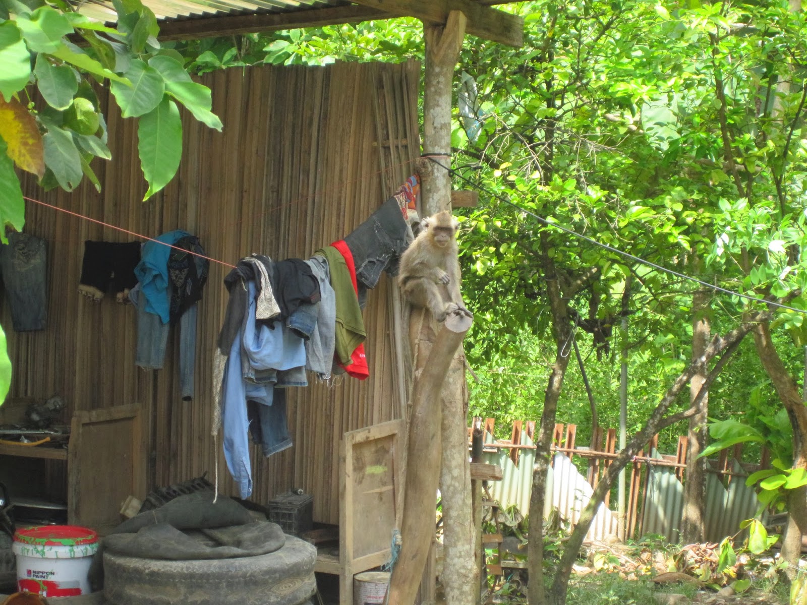
A pet monkey.

Two pet raptors to keep the monkey company.


The return trip was another dose of road peril, but highlighted by an beautiful view of the sunset along the northern coast.  I continue to be entertained by being in the southern hemisphere - the sun and moon traverse the northern sky.  Really though, being near the equator, the sun traverses overhead.  When it sets over the humid Savu Sea, it produces a spectacular sunset.  There will be many more of these moments to come.

The beginning of a spectacular show.


Another day in Dili


Half the day was spent at IPG trying to sort out custom issues and the other half finding a location near Dili for a station.  We travelled to the south about 15 minutes climbing to the small village of Dare.  We are there to visit a Catholic church and talk with the Pastor.  It was along this traverse that the first photo I posted was taken.  The church grounds are especially peaceful.  There is a small school with children between 8-12 years of age.  The site should work, but we need to return to Dili to speak with the Pastor.  We find him in Dili, he is on board, but wants to pass it by the national Bishop.  This may be a good thing for the sake of other locations on church grounds.

The church grounds. A peaceful place.


Field work finally begins


3rd of March.  My first opportunity to leave Dili and make progress in the field.  I head east with director Eugenio Soares and driver "Alex" in IPG's gold Land Rover.  Quick note: This is my first time in a country that drives on left-hand side of road...cool.  We are setting off to deliver letters of endorsement to the Administrators of the Baucau and Los Palos districts.  We visit the cities of the same names. 
The route from Dili to Baucau to Los Palos

I quickly learn that traveling through the country will always be a harrowing experience.  The roads are narrow, just wide enough to squeeze to car widths in.  The roads are rough...very rough.  Traffic is a mix of slow moving motorbikes, fast and slow moving microbuses, slow moving haul trucks, and fast moving SUV/truck vehicles (including our Land Rover).  The roads vary from occasional stretches of straight runs to endless hairpin turn sections.  Within a few meters of the road are villages, the ocean, lagoons, pigs, goats, cows, dogs, people, hand-carts, rocks, etc. 
A typical house along the road.

A microlet minibus traversing the road.  The inside is also full of passengers.

Trying to make our way around a truck.

I am wondering if we will survive...

The driver set out at a furious pace.  I apologize to my wife for not protesting immediately.  When a free stretch of road is available, the driver accelerates to 100 km/hr and doesn't consider slowing until well into the upcoming blind corner.  When in the hairpins, acceleration and rapid braking are the only options.  Weaving between kids and animals that flank the road is done without slowing, aided by riding the horn to alert of the impending doom.  Ok, maybe I am being a bit melodramatic here, but I am reflecting my true experience in the moment. 

We arrive in Baucau, the second most populus city in the country.  As will all other portions of the traverse, there are no signs indicating direction or destination anywhere.  But no problem, just stop and ask!  We arrive just after noon, and find that the district Admin will be back from lunch at 2pm.  We must wait it out because it will take too long to go on to the next stop and make it back by the end of the work day.  After a $2 fried noodle lunch and some down time, Eugenio and I are in the Admin's office.  In their language, Tetum, Eugenio delivers the goods: he gives the same presentation I gave to the Minister a few days ago.  I sit there and listen while recognizing the general flow of the conversation.  Truely, they speak a mixture of Tetum and Portugese, and my knowledge of Spanish is semi-relevant.  I am drenched in sweat during the whole meeting, trying not to deliver a mixed message of nervousness! It goes well and they agree to locate possible sites for immediate installation. Check.

The sign at the entry of the Baucau Admin complex.


On to Los Palos.  We have a few hours to get there.  Across another coastal stretch and then an ascent through lush tropical foliage through a torrential rain.  This is clearly a different microclimate in comparison to the region around Dili.  We emerge on top of a flat, open plain that hosts the Los Palos district.  Los Palos is sparsely populated, and nearly all houses and buildings are right along the road.  We arrive at the Administrator's building, the largest in the area, and check in with security.  There is a handful of men watching what seems to be a bizarre Japanese game show on TV.  We shake some hands and greet them all and the Admin is informed of our arrival.  There are some photos of local flora and fauna on the wall and I take not of a warning of neon green colored Pit Viper snake.  It is a beautiful creature, and I expect to see one at some point in the future.  Mental note: ALWAYS sweep a field site before digging in to work! 
Again, Eugenio delivers the goods, and this Admin is quite interested in the science.  He keeps saying "terremoto" and Eugenio is confused, thinking that he means 'seismometer.'  Terremoto is Spanish/Portugese for "Earthquake."  I later learn the Tetum way to say earthquake: Rrai nacodoco.  It literally means 'earth shake' and is it fun to say...make sure to roll the 'r' in rrai.  It is agreed that we will install the station on the grounds of the Admin building as it is the only safe place to install it in the area. Check.

It is 5pm, and time for the 6+ hour drive back.  Since we are near the equator, there is 12 hours of sunlight every day, so it is light until 7.  That is when I find out that the Land Rover has pitiful headlights.  The high beams are almost as good as normal lights.  To further complicate the matter, drivers communicate by flashing each other with variable patterns.  This adds some more time to the trip home.  I am VERY happy when the long day is over.